Field GPS Topography
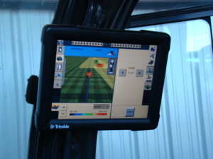 D&H utilize an industry leading soil map GPS solution that uses advanced sensors, intelligent targeting and geo-processing algorithms to produce high resolution, accurate soil and topographic information. By providing a greater understanding of the physical and chemical characterization of the soil, including how inputs move through the soil, D&H can provide more effective solutions to resolve the unique challenges in each area of their fields. This detailed soil map is key to the successful design and engineering of a subsurface drip system. Analysis include soil texture, compaction characteristics, root zone depth, macro and micro-nutrient levels, and moisture holding capacity which determine irrigation, drainage, and fertility. Variable rate application maps will help each grower maximize plant growth.